
What is the official weather forecast issued by the India Meteorological Department for coastal Andhra Pradesh and Odisha?
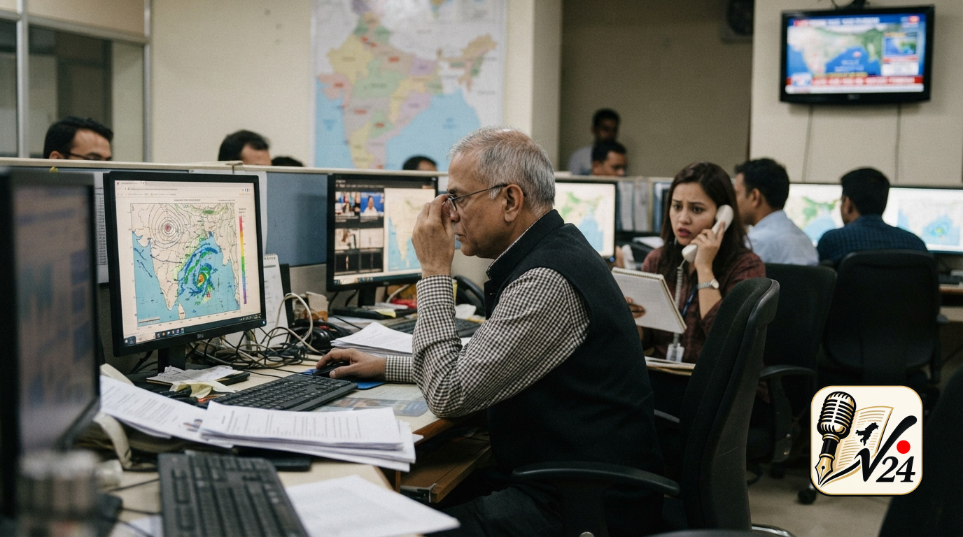
The India Meteorological Department has issued a weather update highlighting the formation and advancement of an atmospheric weather system that is bringing significant weather changes to the eastern coast of India. According to the meteorological agency, a well-marked atmospheric depression located over the Bay of Bengal has continuously intensified as it moves closer to the mainland. The latest bulletins from the weather department indicate that this intensifying system is scheduled to bring substantial rainfall activity to coastal regions in the coming days. Specifically, the forecast warns of very heavy rain spreading across parts of south Odisha and the northern coast of Andhra Pradesh starting from Wednesday. As the system moves closer, localized weather patterns along these coastal belts are expected to experience increased cloud cover, wind speeds, and widespread precipitation. Meteorological experts tracking the progress of the depression note that the intensity of rainfall may vary across districts, but the broad swath of coastal territory under alert requires heightened vigilance from both residents and municipal administrative bodies.
When is the intensifying atmospheric depression expected to cross the coastal regions?
Based on official tracking models and updates released by meteorological authorities, the intensifying depression is scheduled to cross the northern Andhra Pradesh coast on Wednesday. Atmospheric monitoring indicates that the weather system has been gaining strength while navigating the maritime region of the Bay of Bengal, establishing a clear trajectory toward the mainland. The timeline provided by the India Meteorological Department designates Wednesday as the critical period during which the center of the depression will make landfall or pass closest to the northern district boundaries of Andhra Pradesh. The progression of the weather system up to Wednesday is anticipated to cause deteriorating weather conditions, marked by increasing rainfall and coastal wind activity. Weather analysts continuously review satellite imagery and radar data to refine the precise timing and movement of the system, but administrative frameworks have aligned their operational response with the Wednesday timeline to ensure full readiness prior to the arrival of peak weather impacts.
Where are the primary impact zones identified by weather forecasters along the eastern seaboard?
The primary impact zones identified in the latest meteorological briefings span across the northern maritime districts of Andhra Pradesh and the southern coastal regions of Odisha. Within Andhra Pradesh, the northern coastal belt—including districts such as Visakhapatnam—falls directly along the forecasted trajectory of the advancing weather system. Neighboring districts situated near the northern border of the state are also anticipated to experience heavy precipitation and gusty conditions as the depression moves inland. Simultaneously, the forecast extends the heavy rainfall alert into south Odisha, where coastal and adjacent inland areas are expected to see elevated rainfall levels beginning Wednesday. The geography of these combined regions makes them particularly vulnerable to localized waterlogging, temporary inundation of low-lying terrain, and disruptions to routine daily transport and maritime operations. Consequently, the territorial scope of the official alert encompasses a wide multi-state coastal corridor, requiring coordinated monitoring across state and district administrative lines.
How are local administrative officials in Visakhapatnam preparing for potential rain-related disruptions?
In response to the severe weather warnings issued by the India Meteorological Department, the local administration in Visakhapatnam has begun proactive precautionary operations to mitigate potential disruptions. The Visakhapatnam District Collector officially instructed municipal officers, departmental heads, and emergency response personnel to remain on high alert across all administrative jurisdictions. The instructions emphasize the immediate operational readiness of district emergency mechanisms, local municipal bodies, and public safety teams. Administrative personnel have been directed to closely track real-time weather updates, review drainage and flood control infrastructure, and ensure that emergency response machinery can be deployed at short notice if conditions deteriorate. Departmental leaders in Visakhapatnam are conducting internal evaluations to verify that essential service providers, including medical, civil defense, and public works personnel, maintain adequate resources to address potential issues such as fallen trees, localized flooding, or power supply disturbances during the period of intense rainfall.
Why have meteorological authorities raised alert levels across south Odisha and north Andhra Pradesh?
Meteorological authorities raised alert levels across south Odisha and north Andhra Pradesh because the depression approaching the region has shown consistent signs of intensification. When an atmospheric depression intensifies over warm coastal waters, it gathers significant moisture and kinetic energy, increasing the likelihood of widespread, heavy-to-very-heavy rainfall over adjacent landmasses. The decision to issue higher alert statuses is rooted in the potential risks posed by concentrated rainfall within short timeframes. Heavy precipitation can quickly strain urban storm-water management systems, trigger temporary waterlogging in low-lying residential sectors, impair road transport, and impact agriculture in rural districts. Furthermore, the arrival of such weather systems is often accompanied by rough sea conditions and elevated wind speeds, creating hazards for coastal populations and maritime workers. By elevating the alert status in advance, weather agencies aim to provide administrative bodies and the public with adequate lead time to implement preventive measures, secure infrastructure, and minimize safety hazards.
Who is leading the administrative response and operational readiness in the affected coastal districts?
The administrative response across the impacted coastal territory is being spearheaded by district collectors and local civil administrators, alongside forecasting teams at the India Meteorological Department. In Visakhapatnam, the District Collector has taken a central leadership role by issuing directives to departmental officials and emergency services, establishing clear operational expectations for district machinery. District collectors across neighboring coastal jurisdictions in north Andhra Pradesh and south Odisha are similarly overseeing preparedness operations within their respective municipal borders. These local administrative leaders work in close alignment with state disaster management agencies and technical experts from the weather department, who provide continuous updates on the depression's location, speed, and intensity. Through this structured leadership hierarchy, local governance bodies ensure that operational guidelines published by central weather authorities are translated into concrete field actions, emergency staffing schedules, and public advisory notices.
What directives have been issued to administrative departments to handle potential heavy rainfall?
The directives issued to administrative departments center on constant surveillance, operational availability, and rapid deployment readiness. The Visakhapatnam Collector specifically mandated that key departmental personnel remain accessible and prepared to execute emergency response procedures as the weather system approaches the coast. Instructions include maintaining active communication channels between district headquarters and field offices, verifying the readiness of emergency equipment, and monitoring sensitive or low-lying geographical areas vulnerable to flooding. Revenue, municipal, engineering, and disaster management teams have been told to monitor urban drainage networks to clear blockages that could hamper water runoff during severe downpours. Additionally, district officials have been tasked with maintaining emergency relief protocols, ensuring that temporary shelter arrangements and communication systems are operational if evacuation or rapid intervention becomes necessary during peak rainfall periods.
How do local authorities plan to maintain public safety and mitigate risks during the event?
Local authorities plan to maintain public safety and mitigate environmental and structural risks by combining early warning dissemination, inter-agency coordination, and localized administrative vigilance. By issuing timely public advisories based on India Meteorological Department alerts, district administrations aim to keep citizens informed about expected rainfall schedules and localized weather risks. In high-density urban areas like Visakhapatnam, field workers and municipal engineering teams are deployed to monitor crucial infrastructure, including major roads, bridges, and low-lying residential layouts. Administrative guidelines stress the importance of quick response mechanisms to clear debris, restore disrupted utility lines, and manage localized water accumulation. By maintaining continuous communication with emergency response units and keeping administrative teams on active duty throughout the duration of the weather event, local governments seek to systematically address hazards and maintain civic stability as the depression crosses the coast.
Sources
More from National